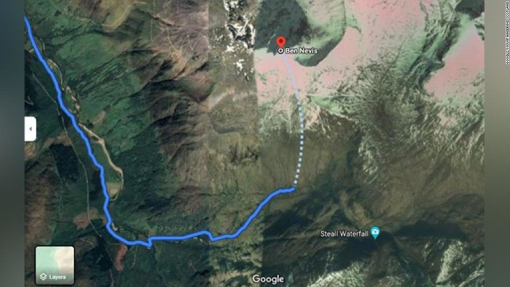
グーグルマップ、「死の可能性」のある登山ルートに誘導 英団体が警告

British Mountaineering Group Warning about the Google Maps’ ”Potential Death” Hiking Route

British Mountaineering Group Warning about the Google Maps’ ”Potential Death” Hiking Route
英スコットランドの複数の登山団体はこのほど、ベンネビス山などの登頂を目指す登山客がグーグルマップによって「死に至る可能性」のあるルートに誘導されていると警告を発しました

Several Scottish mountaineering groups warn hikers about the dangerous, deathly route in Google Maps that guide those aiming to climb the peak of Mt. Ben Nevis

Several Scottish mountaineering groups warn hikers about the dangerous, deathly route in Google Maps that guide those aiming to climb the peak of Mt. Ben Nevis
英ジョン・ミューア・トラストは15日、グーグルマップの利用者が「経験豊富な登山者にとっても非常に危険」なルートに誘導されるリスクが増えていると明らかにしました

John Muer Trust said on 15 July that the number of Google Maps users who try to pass through routes that are considered as very dangerous by experienced climbers have been increasing.

John Muer Trust said on 15 July that the number of Google Maps users who try to pass through routes that are considered as very dangerous by experienced climbers have been increasing.
ベンネビス山はブリテン諸島で最高峰の山で、標高は1345メートル

Ben Nevis is the highest mountain in the British Isles, with an altitude of 1345 masl.

Ben Nevis is the highest mountain in the British Isles, with an altitude of 1345 masl.
毎年数千人が山頂にたどり着くが、登頂には危険が伴い、今年も複数の死者が出ています

Thousands of people reach the summit every year, but climbing is dangerous and there are multiple deaths this year as well.

Thousands of people reach the summit every year, but climbing is dangerous and there are multiple deaths this year as well.
ジョン・ミューア・トラストによると、問題はグーグルマップが一部の登山客を「アッパーフォールズ」と呼ばれる駐車場に誘導していることにあります

According to John Muir Trust, one of the problems is the fact that Google Maps keeps guiding mountain climbers to the Upper Falls parking area.

According to John Muir Trust, one of the problems is the fact that Google Maps keeps guiding mountain climbers to the Upper Falls parking area.
